Our Services
Welcome to Orbis UAV's comprehensive suite of services, where innovation and precision redefine how businesses manage their projects and assets. From aerial mapping and jobsite monitoring to aerial and facade inspections, we offer cutting-edge solutions to meet your diverse needs.
Our aerial mapping service utilizes advanced drone technology to create detailed 2D and 3D maps of landscapes, construction sites, and large areas with unparalleled accuracy.
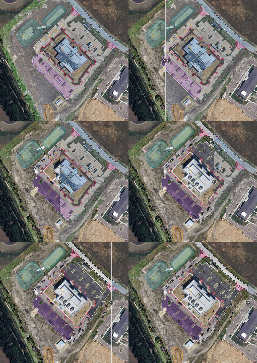
With our jobsite monitoring service, we provide real-time monitoring of construction progress and operational activities, enabling proactive decision-making and efficient project management.
Our aerial inspections service offers a safe and efficient solution for conducting inspections of infrastructure, buildings, and landscapes, while our facade inspection service utilizes drone technology and advanced software to ensure the safety and integrity of building exteriors.
At Orbis UAV, we are committed to delivering superior quality, efficiency, and safety in every service we offer. Trust us to elevate your projects to new heights with our innovative solutions.
Aerial Inspections
Aerial inspections utilize drones to perform detailed assessments of infrastructure, buildings, and landscapes from above. By capturing high-resolution imagery and data, aerial inspections provide valuable insights into the condition, integrity, and maintenance needs of structures, helping businesses and organizations make informed decisions and ensure safety and compliance.
Aerial Mapping
Aerial mapping and surveying involve the use of drones to create accurate maps, 3D models, and survey data of landscapes, construction sites, and agricultural areas. By capturing detailed aerial imagery and data, aerial mapping and surveying enable precise measurements, analysis, and planning for various applications, including urban planning, land development, and environmental monitoring.
Jobsite Monitoring
Our advanced drones provide accurate documentation of site conditions, including precise volumetric measurements of material piles. Scheduled mapping flights offer real-time progress monitoring, while advanced analysis capabilities allow for side-by-side comparisons and blueprint overlays on drone-generated maps. Trust Orbis UAV to streamline operations, protect against liabilities, and achieve project success with confidence.
Facade Inspections
Facade inspections employ drones such as the DJI Mavic 3 Enterprise to conduct thorough assessments of building exteriors and structures. By capturing detailed aerial imagery and data, facade inspections provide valuable insights into the condition, integrity, and maintenance needs of facades, enabling proactive maintenance, safety compliance, and preservation of architectural assets.


